Charles William (Bill) Brubaker (1926-2002) was a member of the Chicago-based architecture firm Perkins & Will from 1950 until 1998. First joining the firm as an intern, he rose to become its President and Chairman (1968-1974).

|
| Chicago in the 1970s |
Best known for his work designing schools, Brubaker also authored articles and books on school design and urban planning, served on Chicago’s Metropolitan Planning Council, and lectured on design of the urban environment.
These amazing photos from UIC Library Digital Collections are part of Brubaker’s personal slide collection. They show aspects of the built environment of Chicago and the surrounding metropolitan area during the 1970s.
 |
| View looking north along North Michigan Avenue from just south of the intersection with East Superior Street, 1970 |
 |
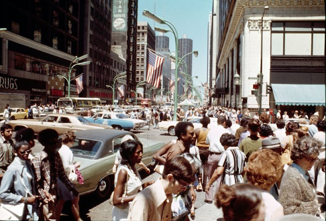
| View of pedestrians walking in Grant Park with the Loop skyline in the distance, 1970 |
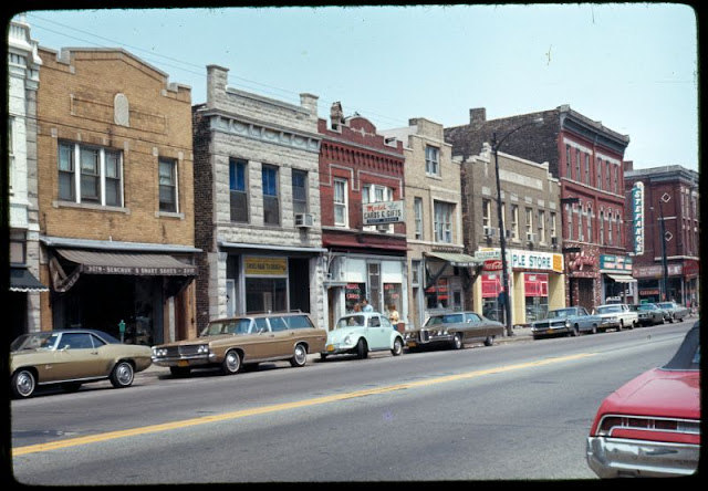 |
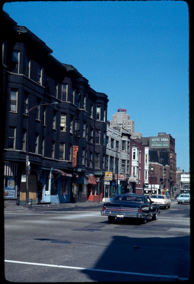
| View of two- and three-story buildings along the north side of West Chicago Avenue, with businesses on the ground floor and apartments above, 1970 |
 |
| North Sedgwick Street from south of the CTA elevated train tracks, 1971 |
 |
| Touhy Avenue and elevated train tracks, 1971 |
 |
| View looking east along Grand Avenue from Michigan Avenue toward the high-rise Time-Life Building (541 North Fairbanks Court), 1971 |
 |
| View looking east along Ohio Street towards the Time-Life Building (541 North Fairbanks Court), 1971 |
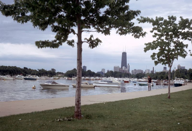 |
| View of boats in the Diversey Harbor, located within Lincoln Park, 1971 |
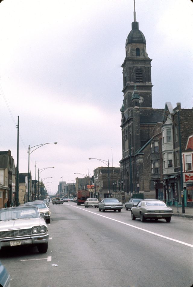 |
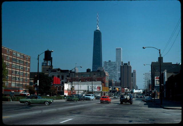
| South Commercial Avenue and Immaculate Conception Church, 1972 |
 |
| View looking north along a thriving commercial strip on South Michigan Avenue, 1972 |
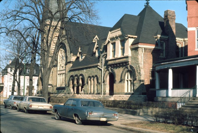 |
| View looking northeast at the front of the Greenstone Church, 1972 |
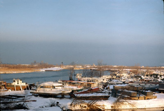 |
| View looking northwest from Calumet Marina, located along the east bank of the Calumet River at East 136th Street and South Torrence Avenue, 1972 |
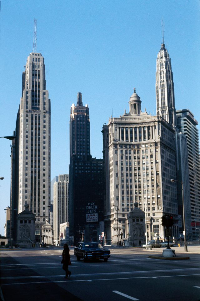 |
| View looking south along Michigan Avenue from the northern end of the North Michigan Avenue bridge, 1972 |
 |
| View of the Auditorium building and Congress Hotel along Michigan Avenue, 1972 |
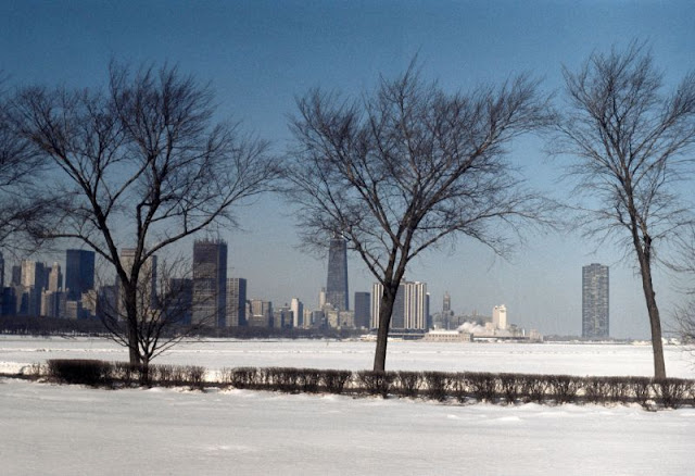 |
| View of the Chicago skyline in winter, looking northwest from near the Adler Planetarium, 1972 |
 |
| View of the Newberry Plaza condominium tower during construction, looking west along Bellevue Place, 1972 |
 |
| View to north from West Kedzie Street, 1972 |
 |
| Calder sculpture, Chicago Federal Center, 1973 |
 |
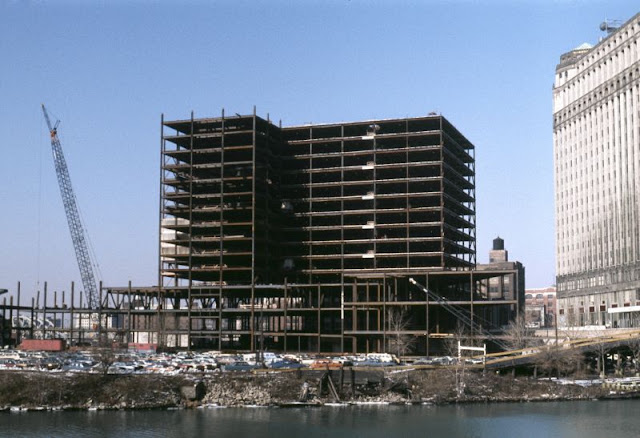
| View of the Standard Oil Building (now Aon Center) under construction, 1973 |
 |
| Warehouse demolition, North Pier Terminal, and McClurg Court Center apartments, 1973 |
 |
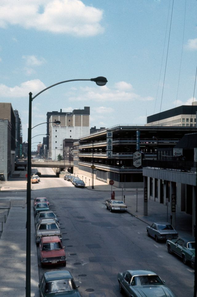
| View looking east along West 95th Street, 1974 |
 |
| View looking northeast along South Champlain Avenue, a residential street in Pullman lined with brick duplex row houses, 1974 |
 |
| View of the Germano-Millgate Apartments, a public housing complex located at 8808 South Burley Avenue, 1974 |
 |
| Argyle Street and Winthrop Avenue, 1975 |
 |
| North Paulina Street just north of Howard Street, 1975 |
 |
| Apparel Center under construction, 1976 |
 |
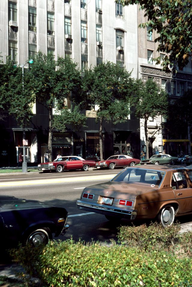
| Chicago Avenue from North Michigan Avenue, 1976 |
 |
| East Erie Street at Rush Street, 1976 |
 |
| East Ohio Street between Rush Street and Michigan Avenue, 1976 |
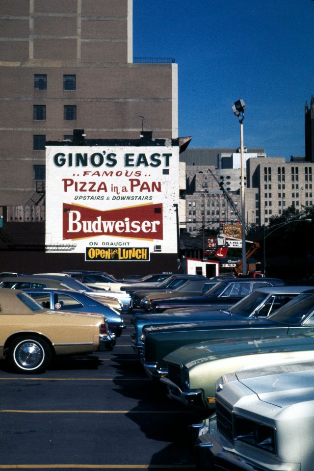 |
| Gino's East pizzeria sign and parking lot, 1976 |
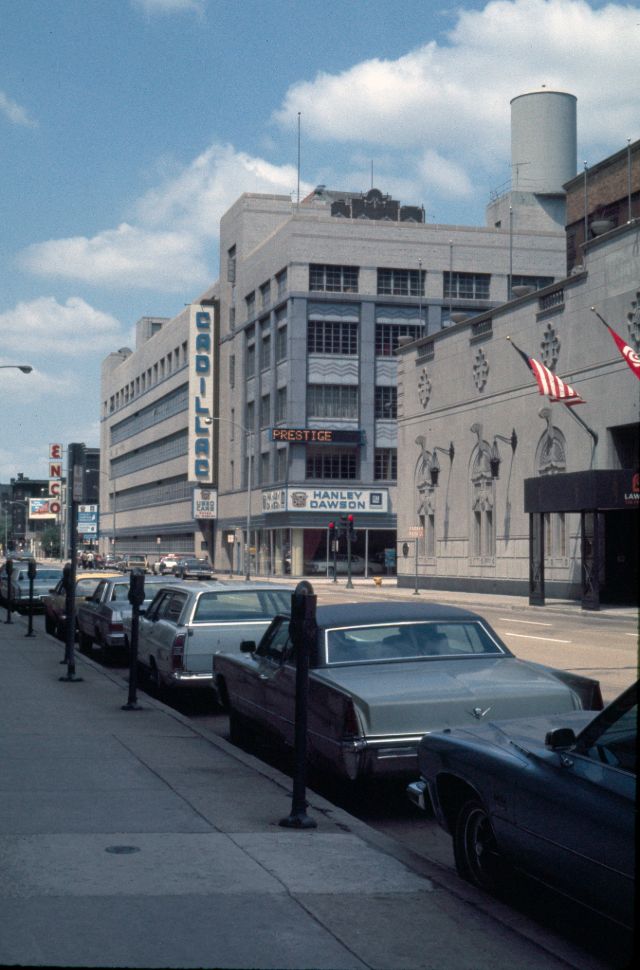 |
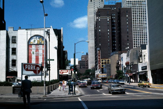
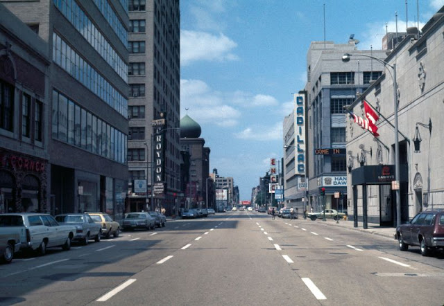
| Hanley Dawson Cadillac and Lawry's restaurant, 1976 |
 |
| North Michigan Avenue at Chicago Avenue, 1976 |
 |
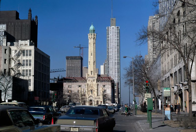
| Pedestrians crossing North Michigan Avenue at the intersection with East Chicago Avenue, in front of the Chicago Water Tower, 1976 |
 |
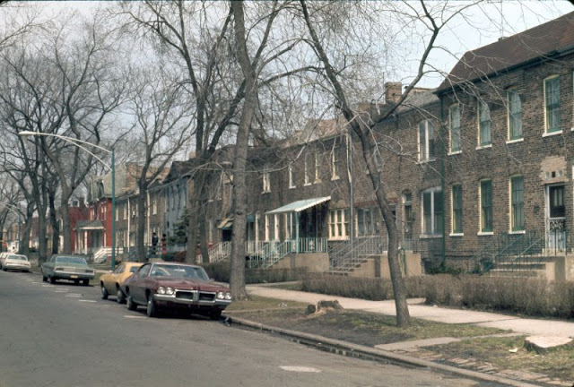
| Residential neighborhood at North Halsted and Blackhawk Streets, 1976 |
 |
| Restaurants on Rush Street, 1976 |
 |
| State Street at Madison Street, 1976 |
 |
| View across East Walton Street towards the entrance to The Drake Hotel, 1976 |
 |
| View along the west side of North State Street, looking north from West Ontario Street, 1976 |
 |
| View looking across North Michigan Avenue towards the high-rise buildings located on the west side of the street south of the intersection with East Superior Street, 1976 |
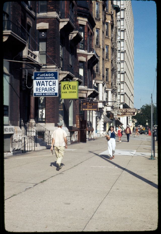 |
| View looking east along the sidewalk on the north side of East Chicago Avenue towards North Rush Street, 1976 |
 |
| View looking east along the sidewalk on the north side of East Huron Street from east of Rush Street, 1976 |
 |
| View looking northwest along North Kingsbury Street, from south of the intersection with West Eastman Street, 1976 |
 |
| View looking southeast from the Kennedy Expressway on-ramp towards industrial buildings along North Orleans Street, 1976 |
 |
| View looking west along East Huron Street, 1976 |
 |
| View looking west along East Illinois Street, from east of the intersection with North Rush Street, 1976 |
 |
| View looking west along East Oak Street from North Michigan Avenue, 1976 |
 |
| View looking west along East Ontario Street, 1976 |
 |
| View looking west along the north side of East Ohio Street, at the intersection with North Rush Street, 1976 |
 |
| View northeast from the intersection of North Wabash Avenue and East Huron Streets, 1976 |
 |
| View of the west side of a nineteenth-century house located at 42 East Superior Street, 1976 |
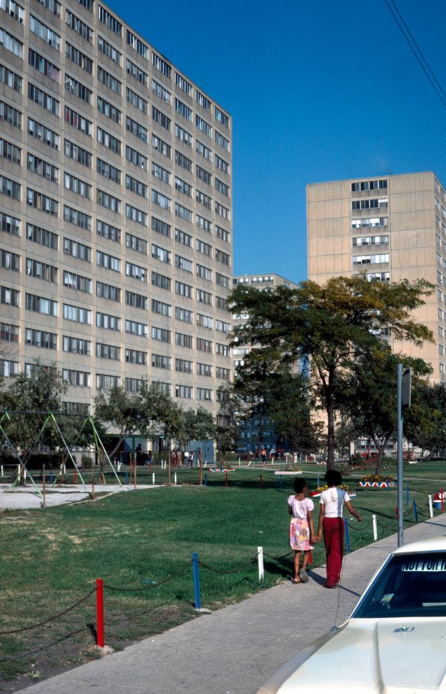 |
| View of the William Green Homes, high-rise apartment buildings in the Cabrini-Green public housing development, looking northeast along the north side of West Division Street, just east of the intersection with North Crosby Street, 1976 |
 |
| View to east along East Chicago Avenue, with the Hotel St. Benedict Flats (42-50 East Chicago Avenue) on the left, 1976 |
 |
| View west from North State Street to the block of North Dearborn Street between West Ohio and West Ontario Streets, with a large parking lot in the foreground, 1976 |
 |
| West Chicago Avenue at Hudson Street, 1976 |
 |
| View looking north along the east side of South Kedzie Avenue, 1977 |
 |
| View looking northwest at the Jackson Park station, at the end of the CTA Jackson Park line, 1977 |
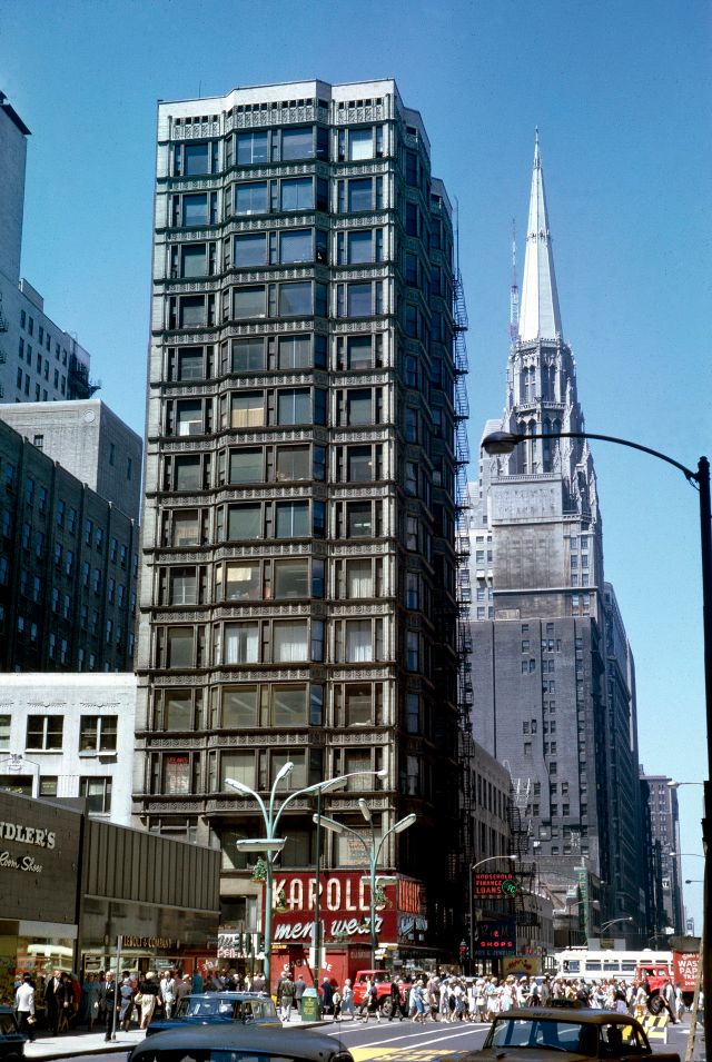 |
| View of the Reliance building, 1977 |
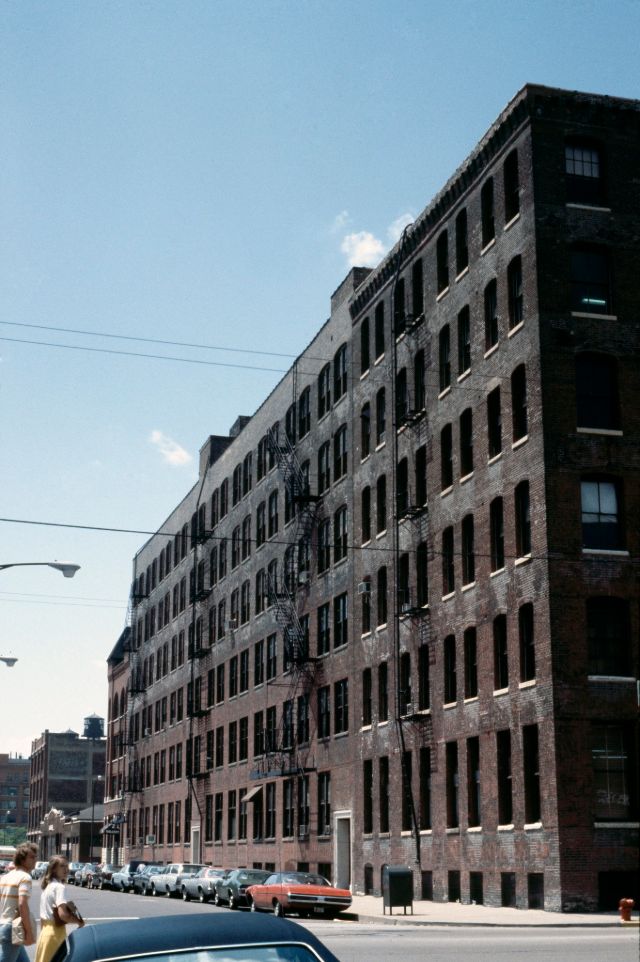 |
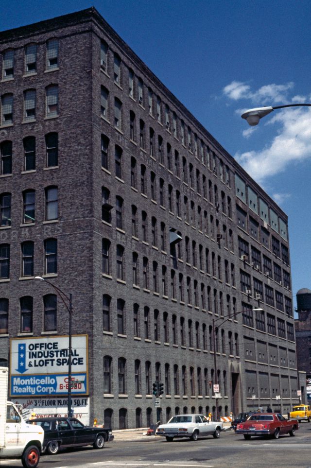
| Brunswick-Balke-Collender Building, 1978 |
 |
| Chicago Fire Department station, West Illinois Street, 1978 |
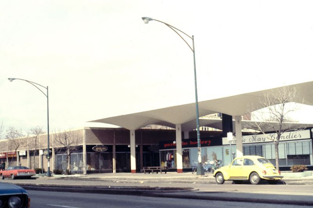 |
| Shopping mall, East 55th Street, 1978 |
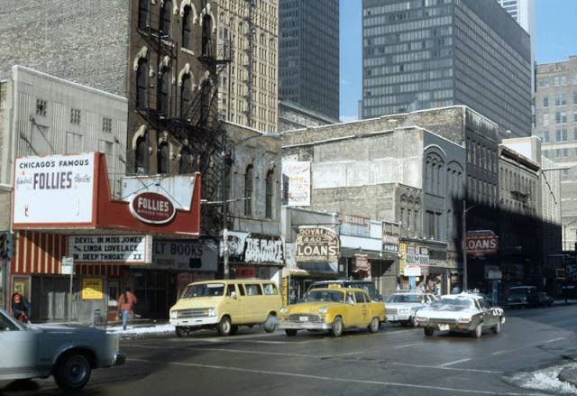 |
| South State Street and Follies Theater, 1978 |
 |
| South State Street at West Harrison Street, 1978 |
|
| View looking east at the Adlake Building (320 West Ohio Street) located at the northeast corner of the intersection of North Orleans and West Ohio Streets, 1978 |
 |
| View looking north across West North Avenue at a Dominick's grocery store, part of the Pipers Alley Mall complex, 1978 |
|
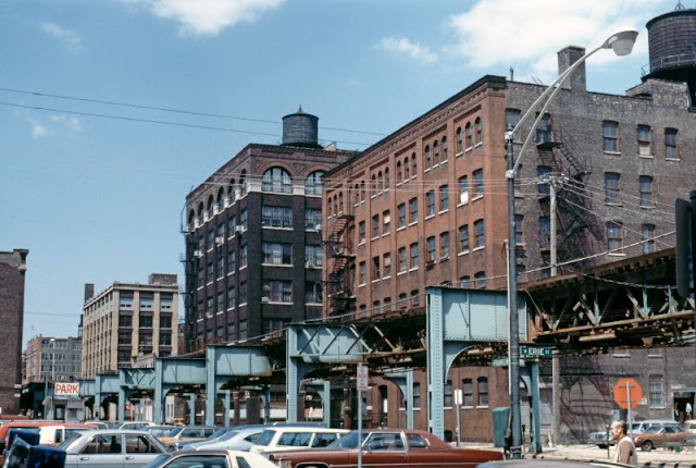
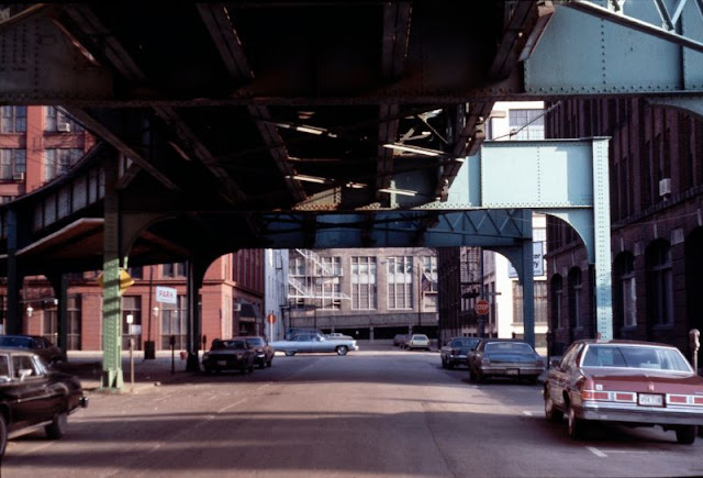
| View looking northeast along North Franklin Street, from the intersection with West Erie Street, 1978 |
 |
| View looking northwest from the intersection of South State Street and Congress Parkway, 1978 |
|
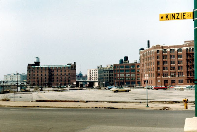
| View looking south along North Franklin Street towards the intersection with West Kinzie Street and the Merchandise Mart, 1978 |
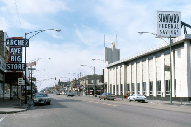 |
| View looking southwest along South Archer Avenue, 1978 |

|
| View of Harper Court, a development project that included clusters of small businesses and artisan shops, located on South Harper Avenue between 53rd and 52nd Streets, 1978 |
|
| View of the Standard Oil Building (now Aon Center) under construction, 1978 |


